Geoparks under preparation
Zemplín Geopark:
From the administrative perspective, the territory of Zemplín covers the districts of Trebišov and Michalovce in the Košice Self-governing Region. From the perspective of tourism regionalization in the SR, the territory is a part of the tourism sub-region Tokaj Hills belonging to the tourism region Dolný Zemplín. Unlike a widely concepted territory called Zemplín that has been defined in the updated Concept of Geoparks in the SR as a territory with the perspective of its incorporation among geoparks, the current territory is concretized and defined with penetrations of borders of more territories, economic interests and local activities, with respect to the densest possible concentration of phenomena worthy of the touristic presentation. Therefore, the territory of Zemplín Hills is proposed as dominant together with Vineyard region of Tokaj, in the penetration with the borders of interesting geological phenomena in the near surroundings and with areas with any other touristic and cultural and social activities (the proposed territory).
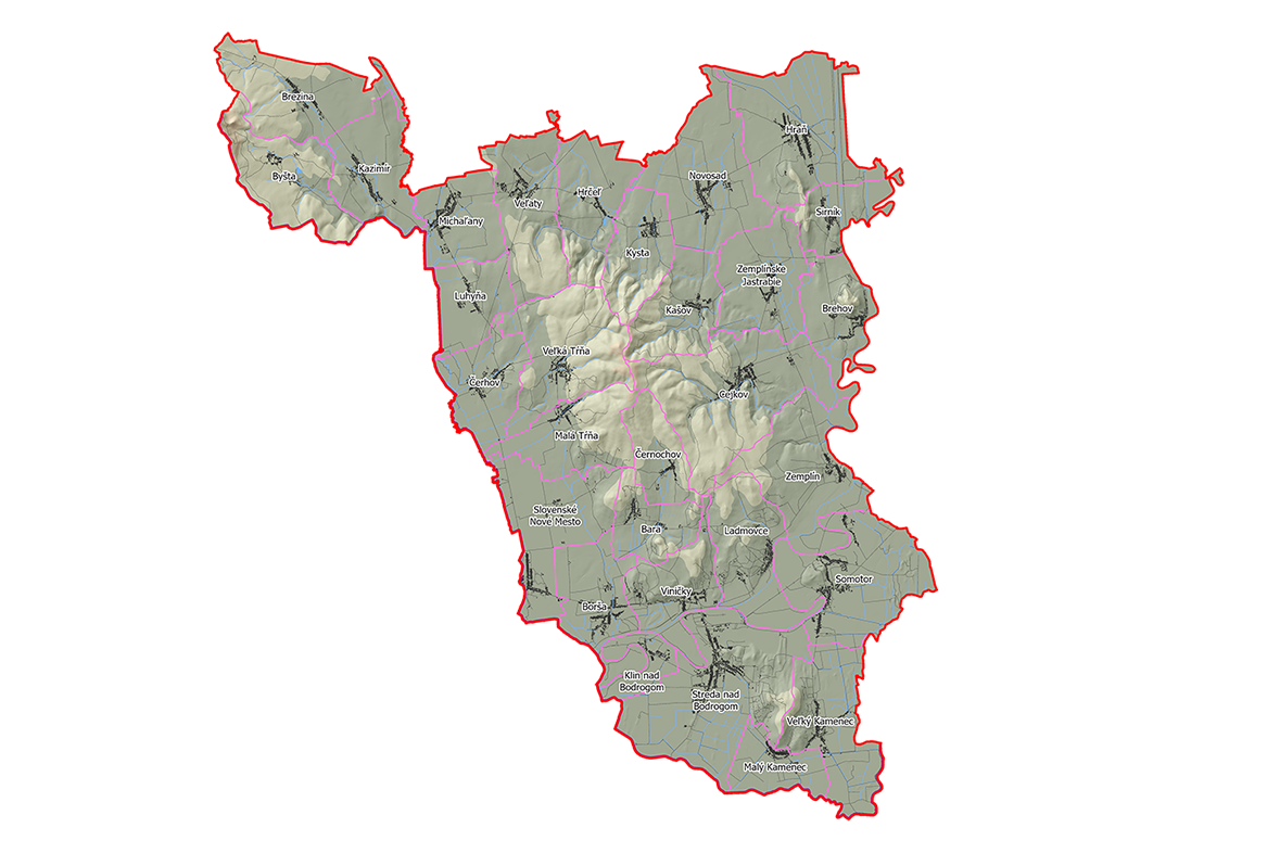
Taking into consideration the possibility of interconnection to the territory of Hungary, therefore, the proposed territory is defined in the southern-western part of the district of Trebišov (in the cadastral districts of the municipalities of Borša, Brehov, Brezina, Byšta, Cejkov, Čerhov, Černochov, Hraň, Hrčeľ, Kašov, Kazimír, Klin nad Bodrogom, Kysta, Ladmovce, Luhyňa, Malá Bara, Malá Tŕňa, Malý Kamenec, Michaľany, Novosad, Sirník, Slovenské Nové Mesto, Somotor, Streda nad Bodrogom, Veľaty, Veľká Tŕňa, Veľký Kamenec, Viničky, Zemplín, and Zemplínske Jastrabie) with the area of 332 km2 (the map included below).
However, the proposed territory is not binding either with its area or the number of cadastres, but it represents the minimal functional basis from the perspective of sustainability of the management of the potential geopark territory. The territory can be enlarged or reduced by the cadastres of municipalities or towns based on the existing links of cooperation and proving the permanent interest to participate voluntarily in the creation of the offer of tourism in the geopark.