Banská Bystrica Geopark
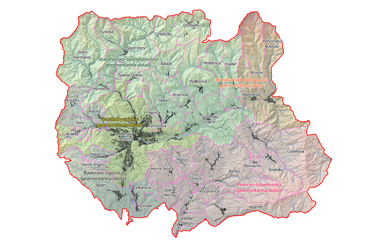
![]() The main assumption for the origin of the project for building the geopark is the existence and using a number of geological, montanistic and the related ecological phenomena and historical monuments of Banská Bystrica and its surroundings. There are mainly two key geomontanic areas: the Stará hora-Špania Dolina and the Ľubietová-Poníky Geo-montanic area. The project was initiated and prepared with the active cooperation of the regional, local self-government, professional institutions in the territory of the town of Banská Bystrica and representatives of the private sector. The geopark is managed by means of the public-private partnership.
The main assumption for the origin of the project for building the geopark is the existence and using a number of geological, montanistic and the related ecological phenomena and historical monuments of Banská Bystrica and its surroundings. There are mainly two key geomontanic areas: the Stará hora-Špania Dolina and the Ľubietová-Poníky Geo-montanic area. The project was initiated and prepared with the active cooperation of the regional, local self-government, professional institutions in the territory of the town of Banská Bystrica and representatives of the private sector. The geopark is managed by means of the public-private partnership.
Geopark area: nuclear territory 206.32 km2
Geopark protection: National park of Low Tatras (NAPANT)
Number of geotopes: 46
Presented themes: geology, montanistics, ecology
Geological characteristics: nuclear mountains, neovolcanites
Contacts
Web pages: www.geoparkbb.sk
Contact address
Banskobystrický geomontánny park
Nám. SNP 13,
976 13 Slovenská Ľupča
tel.: +421 905 258 945 , +421 905 234 256
E-mail: bbgmp@azet.sk, bbgmp@geoparkbb.sk
GPS coordinates : 48.767256, 19.274990
Facebook: geoparkbb